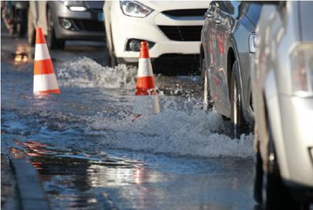
The collaboration begun during year 2021 with the Agency for Territorial Security and Civil Protection has started a new branch of activity: the digitalization aimed to support the handling of hydraulic risks. This kind of risk is particularly relevant for the territory of Emilia-Romagna, which turns out to be among the regions with higher risk level, in an average hydraulic danger scenery evaluation, concerning the population at flooding’s risk.
The risks’ evaluation belongs to a complex process of acknowledgement and planning, carried on by different players. To simplify, the lagoon authorities mainly elaborates data on hydraulic danger, needed to act at a “later time”, which means with structural interventions, such as defence endeavours and maintenance.
Civil Protection plans mainly focus on the provisions for “real time” management. Thanks to the different risk scenarios we are able to evaluate the different effects on the population, on the goods and on the environment, imposed by the development of events such as floods, and also gather other informations, useful to hydraulic surveillance and to the definition of concrete measures to be put into action in case of necessity. This is, briefly, the framework in which Lepida is conducting designs and implementations of digital tools to support the Agency’s hydraulic risks planning.
The first aspect concerns the digitized management of the abundant documentary material, made of studies, detailed reports and models, most of which are born from several collaborations with different companies. The goal is to make them more available, both for the elaboration of risk scenarios and for the management of actual emergencies. The second level of collaboration concerns the representation of information developed on European projects, by evaluating the currently available technologies, on visualization and WEB based GIS platforms.